New Caminito del Rey
Luis Machuca- Type Bridge / footbridge Refurbishment Culture / Leisure Infraestructure
- Date 2016
- City Malaga
- Country Spain
- Photograph Duccio Malagamba John Nazca Reuters
Inaugurated in 1921 by King Alfonso XII of Spain, El Caminito del Rey is a narrow footbridge that was built as a service path for workers, who had to move from the Conde de Guadalhorce dam up to the hydroelectric dam of El Chorro. Little by little it became part of the daily life of the local population, and even started to be used as the shortest route to take children to school, close to the reservoir. When the path lost its industrial role at the end of the century, it began to fall apart because of the action of nature itself. The recovery of El Caminito del Rey is important not only as a tourist draw but also as a reivindication of the historic value of the Desfiladero de los Gaitanes (Gaitanes Gorge).

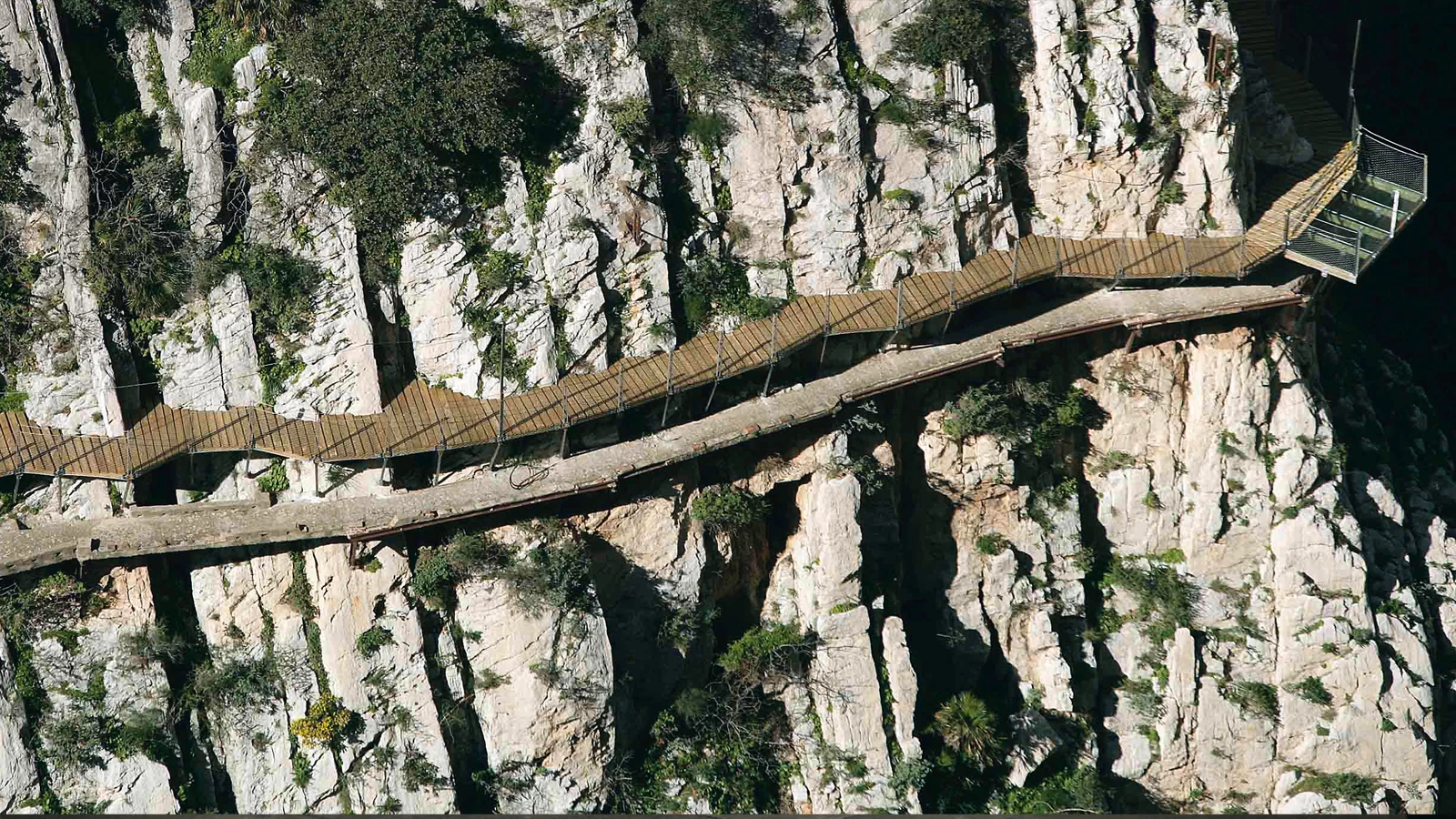
Between the towns of Álora, Antequera, and Ardales, El Caminito del Rey stretches through the Desfiladero de los Gaitanes (Gaitanes Gorge), a 3-km canyon by River Guadalhorce in the mountains of Málaga.

To recover the entire infrastructure it has been necessary to combine an environmental project, an urban project, and broader territorial plans (approved as the ‘Plan Especial del Caminito del Rey y su entorno’, or special plan for El Caminito del Rey and its environment), and a technical executive project to build the footbridges, control cabins, and visitor centers. The area is located amid three municipal areas in the center of the province of Málaga: Ardales, Antequera, and Álora. The total route is 7.7 kilometers, of which 4.8 are accesses and 2.9 are footbridges. As for the footbridges anchored to the walls of the gorge (the most famous part of the route), the distance between the entrance and the exit is 2.9 kilometers (1.5 kilometers of footbridges and 1.4 of forest trail). The footbridges are sometimes one hundred meters above the river level.


The recovery seeks a minimum intervention on the rock; the footbridges, conceived as an organic whole, adapt gradually to the slopes and to the old path, which take on a prominent role as a piece of industrial archaeology.


The project proposes a mimetic building system that follows the slope and adapts to the vertical topography as if it were a living being that adheres to the rock. The recovery of the path is the first part of a plan that must keep human impact from deteriorating the area while contributing to the region’s economic growth and well-being. It is a key site because of its rich landscape as well as its anthropological and archaeological value, particularly important because of its wildlife, vegetation, and special geology, which until just recently attracted only extreme sports enthusiasts. The preservation of the old infrastructure, which is kept as a remnant of industrial archaeology, and the system of new footbridges, which respects the natural environment and minimizes the impact of the project, turn the renovated path and environs into an exceptional place.


Built with wood and stainless steel, very light and flexible, the new footbridge system rises 100 meters high above the level of the river. Because its respects the environment, the intervention is reversible.


Cliente Client
Diputación Provincial de Málaga
Arquitecto Architect
Luis Machuca Santa-Cruz
Equipo Team:
María Luisa Escudier, Manuel José Rodríguez, Borja Peñalosa (arquitectos architects); Amor Olveira (asesora jurídica legal advisor); Encarna León (geógrafa geographer); Aurora Quesada (bióloga biologist); Carlos Vasserot (economista economist); José Luis Escolano (ingeniero de caminos civil engineer); José Ángel Mata (ingeniero técnico industrial industrial technical engineers); José Luis Juanas (arquitecto técnico quantity surveyor); Juan Schwarzmann (estructuras structures); Luis Machuca (dirección de obra project management)
Contratista Contractor
Sando Construcciones
Presupuesto Budget
2.692.921 €
Fotos Photos
Duccio Malagamba, John Nazca/Reuters, Luis Machuca y Asociados


